

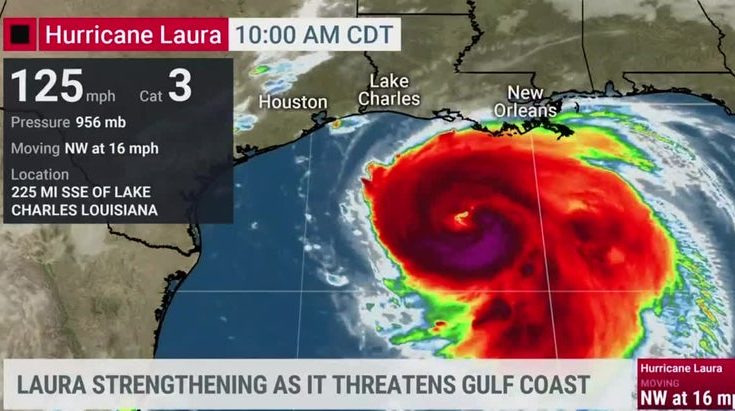
Hurricane Laura is then forecast to strike the U.S. coast somewhere between Houston and New Orleans, posing risks to supply chain operations at Port Houston, the Port of Galveston, Port Arthur—which is home to the nation’s largest oil refinery—and the Port of New Orleans, which remained on high alert today.
For truckers, downed trees and road closures are major concerns along Interstate 10, as it runs east-west through Louisiana and Texas. High winds and flooding could also close some stretches of Interstate 45, which stretches from Dallas to the Gulf Coast.
Officials for Houston Airport System (HAS) said as of late Tuesday they hadn’t canceled any cargo flights yet, but that could change as Laura moves closer. HAS also operates George Bush Intercontinental Airport, as well as William P. Hobby and Ellington airports, which are still open at this time.
Class I railroads with operations along the Texas-Louisiana Gulf Coast, such as BNSF and Norfolk Southern, are also taking precautions to protect infrastructure and rail equipment from possible flooding, officials said.
Sources: The Weather Channel, DCVelocity, Freightwaves